
Flyover KH Noer Ali in Bekasi: Traffic Under the Landmark
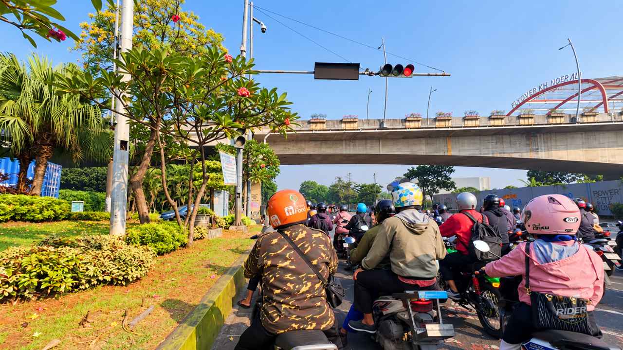
Morning in Bekasi often begins the same way: a stream of motorbikes threading through the city, and one of the busiest meeting points is the traffic light under Flyover KH Noer Ali. Riders line up side by side while the concrete span of the flyover sweeps above the intersection.
On a clear day the scene is easy to read. Commuters are on their way to work, delivery riders are already carrying orders, and the flyover name board, FLYOVER KH NOER ALI, stands out against the sky. It is an ordinary red light that happens to sit under one of Bekasi's best-known landmarks.
Key facts at a glance
- Flyover KH Noer Ali crosses the Bekasi railway line, so traffic no longer has to queue at a level crossing.
- It connects central Bekasi with the Summarecon Bekasi area to the north of the city.
- The flyover is roughly 1 kilometre long and about 22 metres wide.
- Its main span is about 130 metres, built with the balanced cantilever method.
- The flyover is named after KH Noer Alie, a Betawi cleric from Bekasi and a National Hero of Indonesia.
- It was inaugurated on 13 April 2013 and has been a city landmark since.
Where is Flyover KH Noer Ali?
The flyover stands in the city of Bekasi, West Java, spanning the railway tracks near Bekasi Station. Because of its location, it is also widely called Flyover Summarecon Bekasi, after the large development on its northern side.
For riders, the name matters less than the function. The flyover lifts vehicles over the railway corridor and links the older centre of Bekasi with the newer northern districts, which is why it stays busy for most of the day.
Why the flyover matters for Bekasi traffic
Crossing the railway without a level crossing
The Bekasi railway line is one of the busiest corridors for trains running to and from Jakarta. Before the flyover, vehicles and trains had to share the same stretch of ground at a level crossing, and every train meant a long queue on both sides.
By carrying the road over the tracks, the flyover removes that conflict. Traffic keeps moving even when a train passes below, which is the main reason the structure was built.
A 130-metre main span
The most interesting part of the construction is the main span that crosses the railway itself. It is about 130 metres long and was built using the balanced cantilever method.
That technique builds the deck outwards from the piers in stages, balancing each side as it grows, so no support column has to stand in the middle of the active tracks below. With trains still running, keeping the railway clear was essential.
Who was KH Noer Alie?
The name on the flyover belongs to a real person, not just a street name. KH Noer Alie (1914-1992) was a Betawi Islamic preacher, teacher and community leader from Bekasi who took part in the struggle for Indonesian independence, including mobilising local fighters against the returning Dutch forces.
He was later recognised as a National Hero of Indonesia. A short profile is available on Wikipedia.
Using his name on one of the city's main pieces of infrastructure is a way of keeping the memory of a Bekasi figure connected to the road that thousands of people use every day.
The scene under the flyover
Photographs taken at the intersection show the landmark from the side most riders know: from the saddle. Motorbikes fill the lanes in front of the red light, helmets and jackets in every colour, with a flowering tree and a strip of greenery on the left and the concrete span of the flyover running across the background.
It is a very Bekasi picture. The city is often described through its traffic, but the traffic is also what makes places like this feel alive: people going somewhere, lights staying bright, and a landmark that no one really looks at until they are asked to.
Rider notes for the KH Noer Ali intersection
- Expect dense motorbike traffic. Keep a safe distance and hold your lane while waiting at the light.
- Watch the road markings. Under a flyover, lanes from several directions can be tight, so read the signs before the intersection rather than inside it.
- Best light for a photo. Early morning and late afternoon give the flyover the clearest contrast; if you stop to shoot, use the pavement and never stop in a live lane.
- Plan around rush hours. The corridor near Summarecon Bekasi is busiest on weekday mornings and evenings.
Frequently asked questions
- Where is Flyover KH Noer Ali located?
- It is in the city of Bekasi, West Java, crossing the railway line near Bekasi Station and linking central Bekasi with Summarecon Bekasi.
- Why is it also called Flyover Summarecon Bekasi?
- Because it is the main access to the Summarecon Bekasi area on the northern side of the city.
- How long is the flyover?
- It is about 1 kilometre long and around 22 metres wide, with a main span of about 130 metres over the railway.
- Who was KH Noer Alie?
- A Betawi cleric, teacher and independence-era figure from Bekasi who is recognised as a National Hero of Indonesia (1914-1992).
- When was the flyover opened?
- It was inaugurated on 13 April 2013.
Flyover KH Noer Ali is more than a piece of concrete over a railway. It is the daily route of thousands of riders, and it carries the name of a Bekasi figure who is part of the city's history.
More route notes and travel stories are on the Rider Street View blog, and the ride that inspired this article can be watched on YouTube.
Tags: Bekasi · Flyover KH Noer Ali · Summarecon Bekasi · Jawa Barat
Discussion
Share what you know about this route. Comments are published straight away, and links are not allowed — write the name of a place instead of a web address.
Loading the discussion…